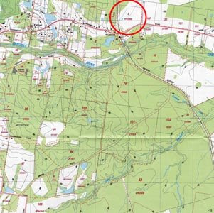
This image can be found at: www.icsm.gov.au/mapping/maps_cadastral.html (If you click on the image located at the URL site, a much larger and detailed image of the map is provided.)
A Cadastral Map commonly includes ownership and boundary details, such as survey district names, positions of existing structures, section and/or lot numbers and their respective areas, adjoining and adjacent street names and selected boundary dimensions. The above Cadastral Map idenifies individual pracels of land in relationship to each other. Additional information is also shown, such as each pracels size, who owns the land and what it is used for. The Cadastral information has been overlaid onto a Topographical map.
No comments:
Post a Comment