This image can be found at: http://www.fgdc.gov/library/whitepapers-reports/annual%20reports/2008/web-version/AppendixC.html
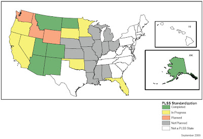
The PLSS Map is used to divide public domain lands, which are lands owned by the Federal government of the United States. The PLSS Map above subdivides the states into 5 categories indicating which states involved in PLSS Standardization. Green states have already completed the process of standardization, yellow states are currently in progress, orange states are planned, grey states have not yet been planned and white states are not listed as a PLSS State.
No comments:
Post a Comment